 ARISE Home
 ARISE Data Center
Other technologies
ARISE2 proposes to foster the development of innovating technologies to improve observations needed to reach ARISE2 objectives, namely : reducing uncertainties; extending range of altitude and increasing vertical resolutions; investigating to allow continuous observations; and finally examining the concept of portable, low-cost and autonomous instruments to test measurements possibilities in new stations.
Microwave (WIRA)
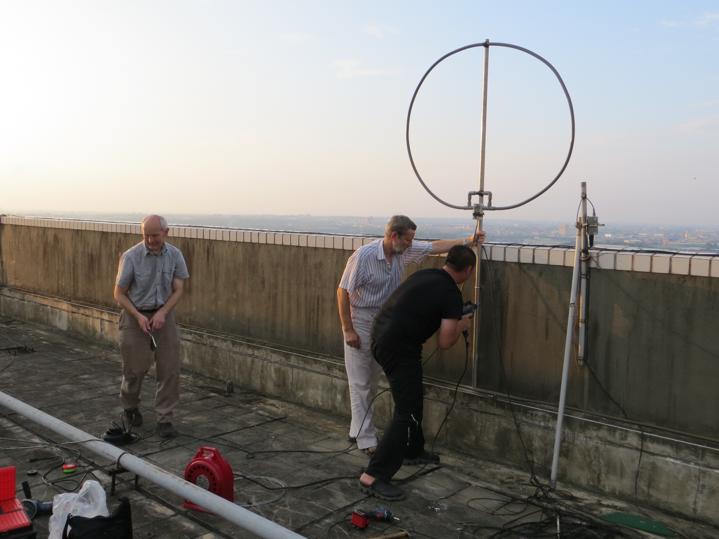
The microwave Doppler spectro radiometer WIRA is a passive ground based instrument specifically designed for the measurement of horizontal wind profiles in the altitude range of 35-70 km.
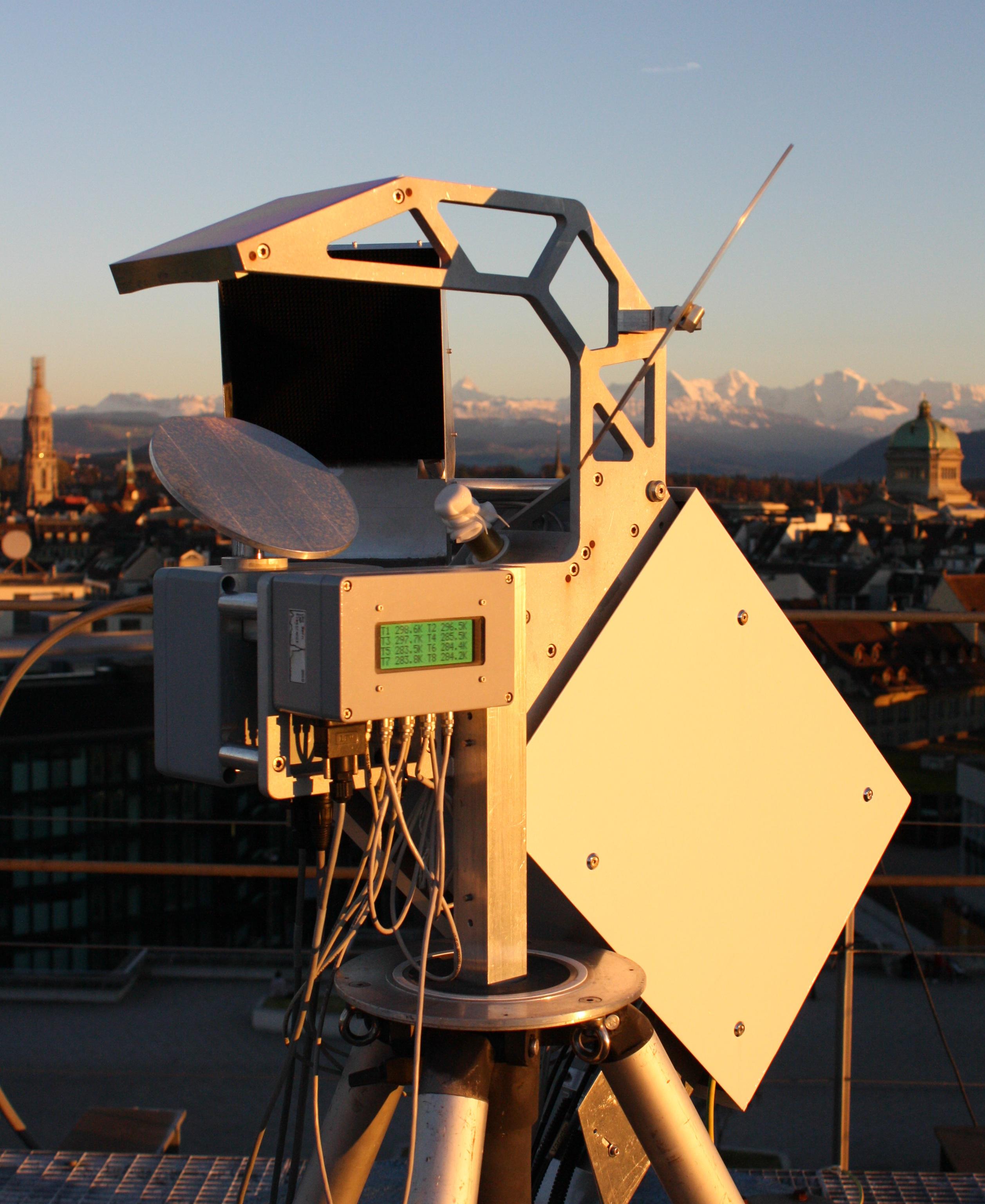
Currently, WIRA is the only existing prototype of a Doppler wind radiometer. During the ARISE2 project, WIRA will be operated at Maïdo Observatory, in La Réunion Island, remotely controlled by the team of UBERN. The data will be used to validate and complement wind profiles obtained by the lidar on Maïdo Observatory. Further studies will be devoted to determine the effect of the gravity waves in the tropical atmosphere.
In addition to WIRA, a second generation wind radiometer called WIRA-C will be built by UBERN for later deployment at one of the ARISE observing sites.
Radars
Through the ARISE2 project, the MST, Meteor and ionospheric HF Doppler Radars will provide, with lidars, day and night measurements to complement the whole ARISE instrumentation and eventually elucidate the dynamics of the middle and upper atmosphere.
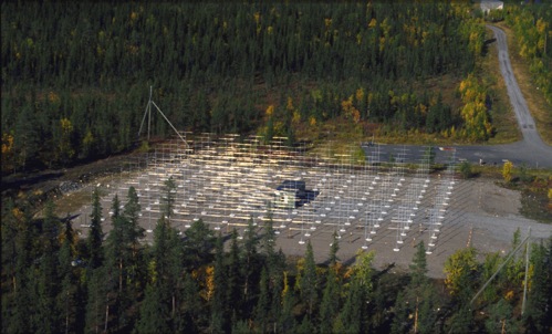
The MST Radars established by IRF |
The MST Radars implemented by IAP-KBORN |
The MST Radars are mainly used for wind profiling the lower troposphere (<10-15 km). They will also, during ARISE2, derive mesospheric (50 to 90km) wind information. One example is the ESRAD (see above, on the left) which can run continuously, cycling between modes optimized for troposphere, stratosphere, or mesosphere. Other MST Radars are also operated by IAP-KBORN.
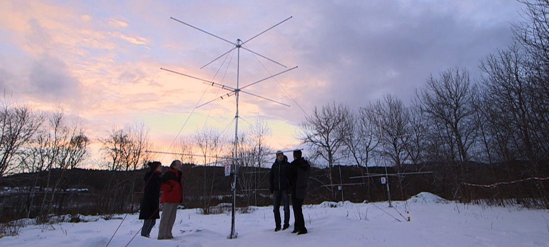
Advanced METEOR radars at the Dragvoll Campus of NTNU
On the other hand,the Meteor Radar and MF Radars will be used by NTNU to develop a spatially and temporally varying climatology of the gravity waves in the mesosphere. Near-continuous meteor Radars measurement have been performed over Trondheim, Norway since August 2012. The Trondheim meteor Radar is a new generation of SKiYMET radars.
Finally, the ionospheric HF Doppler Radars complete infrasound and gravity waves observations in the ionosphere (at altitudes higher than 100km). Examples of sources are severe weather or large earthquakes. Ionospheric Doppler sounding observations are performed by IAP-Prague.
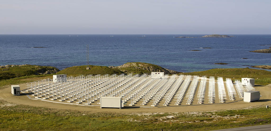
The EISCAT radar (IRF) provides altitude profiles of many ionospheric parameters. The future EISCAT 3D radar will be able to provide winds and turbulences higher than the MST radars altitude range for the study of the coupling between atmosphere and ionosphere.
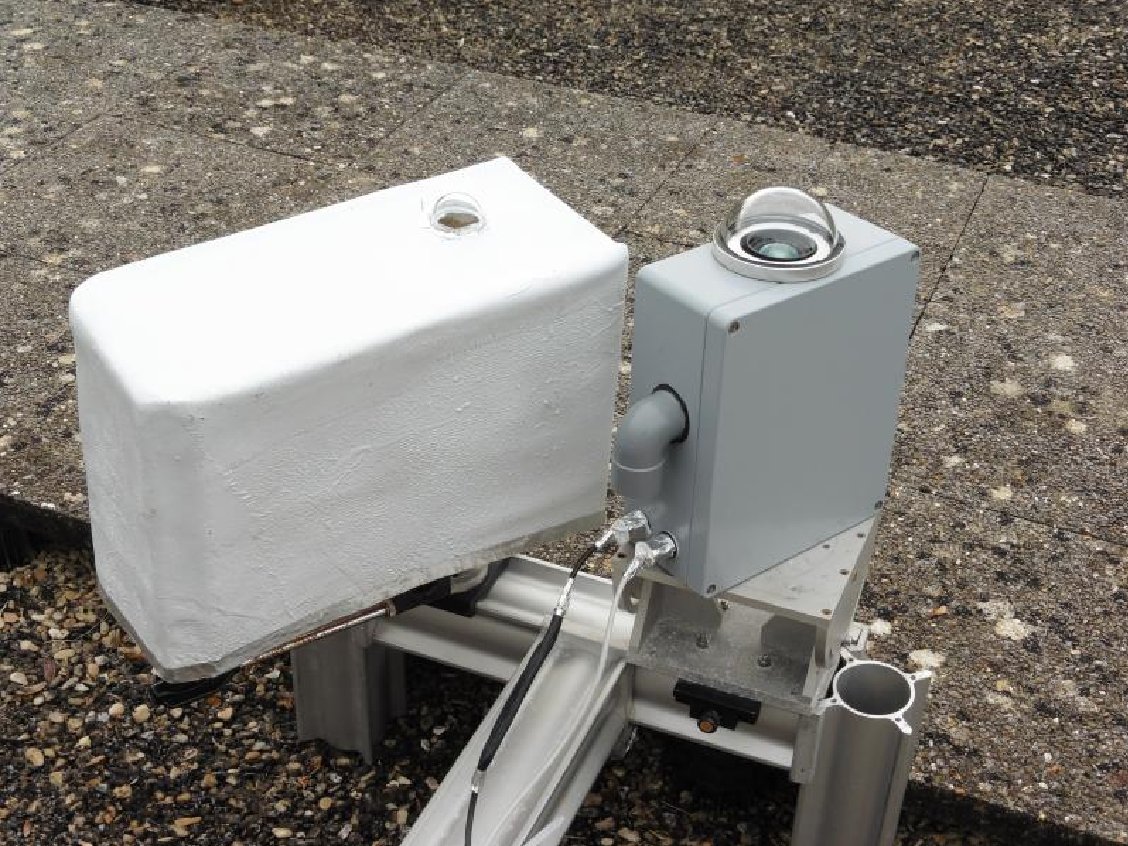
Airglow
 NUIM.jpeg)
|
|
|
|
NUIM Hydroxyl Radiometer |
ONERA instruments (SWIR Camera in the white protection, Spectrometer in the grey box) |
NTNU Multi-Spectral All-Sky Airglow Imager |
The airglow consists of a radiation created by chemical reactions implying vibrational decays. Most of the radiations takes place in the visible and in the short wave infrared region (> 80km). OH excited molecules produce one of the most observed airglow emissions. This radiation is used for the observation of gravity waves using near-infrared cameras and temperature measurements using spectrometers.
It is proposed in ARISE2 to develop new optical instruments to obtain spectral radiance images for large field of view as well as temperature images, leading to the knowledge of the small scale gravity waves propagating in the mesosphere and spatial fluctuations of the temperature at different altitudes. Further complementary airglow imaging will be investigated by NTNU, NUIM and ONERA.
Portable lidars
Statistics about the number of lightning strikes in the Ivory-Coast, using LIS experiment data, showed a large increase of lightning activity between 3 and 10pm local time. One of ARISE2’s aim would be to perform lidar observations at night in relation with thunderstorms in order to quantify gravity wave stratopheric and mesospheric activity above the station.
In this context, the concept of portable, low-cost, autonomous instruments is currently examined by DLR-IPA. A mobile prototype Lidar, with high temporal resolution, which can operate in a nearly automated mode will be developed and installed in Ivory-Coast, where the IS 17 infrasound station is in operation.
A Compact Rayleigh Autonomous Lidar (CORAL) for the middle atmosphere
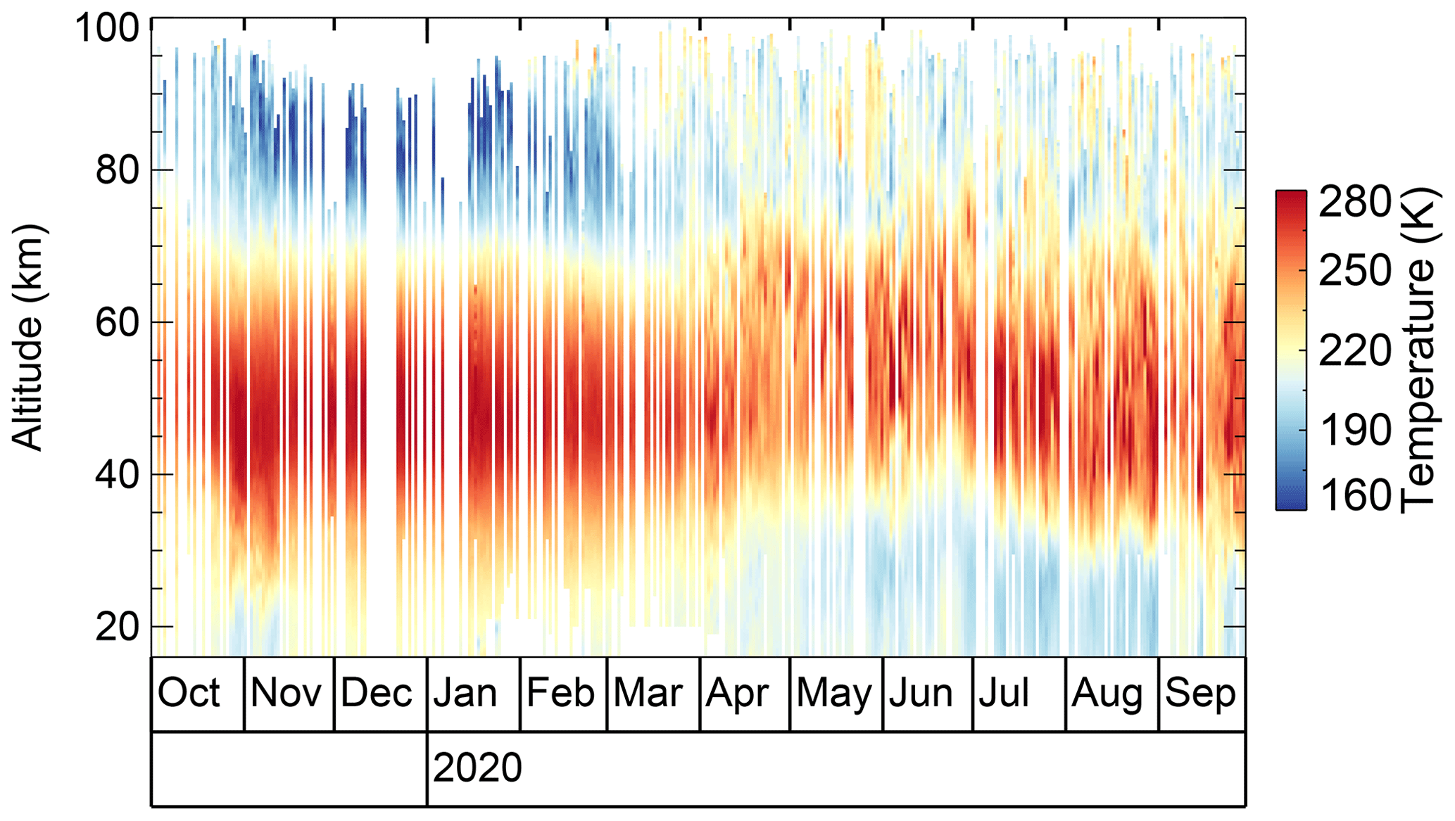
The Compact Rayleigh Autonomous Lidar (CORAL) is the first fully autonomous middle atmosphere lidar system to provide density and temperature profiles from 15 to approximately 90 km altitude. From October 2019 to October 2020, CORAL acquired temperature profiles on 243 nights above Río Grande, southern Argentina, a cadence which is 3–8 times larger as compared to conventional human-operated lidars. The result is an unprecedented data set with measurements on 2 out of 3 nights on average and high temporal (20 min) and vertical (900 m) resolution. The studies using CORAL data show the evolution of a atmospheric gravity wave event and its impact on the stratospheric circulation.
|
|
|
|
A Compact Rayleigh Autonomous Lidar |
Nightly mean temperature profiles acquired by CORAL over a 12-month period in 2019 and 2020 |
https://doi.org/10.5194/amt-14-1715-2021Contact: Bernd Kaifler (bernd.kaifler@dlr.de)