 ARISE Home
 ARISE Data Center
ARISE technologies
Lidar
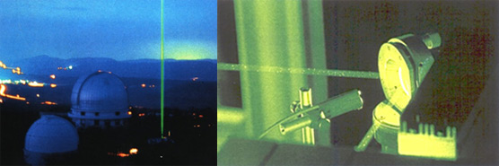
The measurement of stratospheric and mesospheric temperature using Rayleigh lidar technique was initiated 30 years ago at Haute-Provence Observatory by Hauchecorne et al. . Monochromatic laser pulses are sent vertically into the atmosphere and a temporal analysis of the backscattered light provides information about the vertical structure and composition of the atmosphere. Above the top of the stratospheric aerosol layer (about 30 km), Mie scattering is negligible and the received signal due to Rayleigh scattering is directly proportional to the density of the atmosphere. The temperature profile is deduced from the density profile assuming that the density is in hydrostatic equilibrium and obeys the perfect gas law. The profile is limited upwards by the signal to noise ratio to 80 to 90 km depending of the power of the lidar system.
Temperature lidar are well adapted to the study of planetary waves, gravity waves in the upper stratosphere and mesosphere as well as their interaction to induce mesospheric inversions. The stratospheric warming appears to be a strong issue of the evolution of the stratosphere and induced-tropospheric changes. Temperature tides are studied in the frame of the international project CAWSES . There is a strong issue for trends and satellite validation . The Haute-Provence Rayleigh lidar database is the longest temperature series and allowed one of the first detection of the cooling of the upper stratosphere and mesosphere . Now it is a key instrument to insure inter-satellite adjustment like AMSU series.
NDACC sites
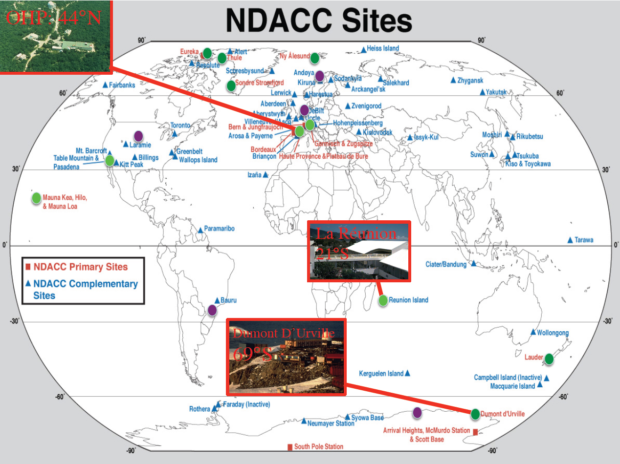
The Network for the Detection of Atmospheric Composition Changes (NDACC) is an international network initially set up in 1991 for the ozone monitoring from ground-based instrument after the ozone hole discovery and the launched of the UARS satellite. Different types of instruments dedicated to ozone and related parameters (temperatur and depleted ozone species) have been selected (passive and active remote sensing, in-situ, profiles and column) including different lidar systems . LATMOS was strongly involved while the Service d’Aéronomie (now LATMOS) has already a long experience in lidar and has demonstrated the concept of regular frequent observations using simultaneous instruments from ground at the observatory of Haute-Provence. For monitoring the stratosphere, 5 primary sites (fully equipped, polar, mid-latitude and tropic in both hemispheres) were initially selected including Observatory of Haute-Provence (mid-latitude north) and the Dumont D’Urville Antarctic stations. France has also proposed to set up a station at Reunion Island (southern tropic) to full-filled the missing latitude band and collaborate at a secondary station at Andoya (only lidar) within the frame of a consortium including Germany and Norway.
Rayleigh-Doppler wind lidars was developed by Service d’Aéronomie to measure the horizontal wind in the stratosphere and in the upper troposphere . It relies on the Doppler shift of a monochromatic laser beam backscattered by air molecules and aerosols. It was first designed to cover the upper stratosphere where the Mie contribution to the signal return can be neglected in most situations and was adapted later to work both on Rayleigh and Mie scattering to be able to work in presence of volcanic aerosols layers like after Pinatubo eruption or thin clouds like sub-visible cirrus.
The Rayleigh-Doppler wind lidar set-up at Haute-Provence Observatory has been used to study gravity wave characteristics and climatology and their interaction with the mean circulation . Some studies have been made to identify the sources of observed gravity waves using a ray-tracing model. A similar wind lidar was installed recently at Reunion Island. Both lidars will be involved in the ground-based validation campaign of the ESA satellite ADM-Aeolus to be launched in 2012. This satellite is dedicated to the measurement of the line of sight wind from 0 to 20 km for the improvement of weather forecast models.